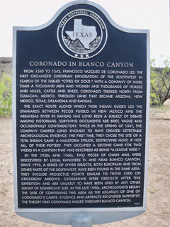
Coronado in Blanco Canyon

Floydada vicinity, Floyd County, Texas
Address: 25 mi. E on FM 97; 5 mi. N on FM 1065
Directions: 8 miles south of Floydada on US 62 in roadside park
Marker #: 5153012355
Year Dedicated: 2000
Size, type: 27" x 42" Subject
Last reported condition: Good
Coronado in Blanco Canyon
From 1540 to 1542, Francisco Vazquez de Coronado led the first organized European exploration of the southwest in search of the fabled "cities of gold." With a company of more than a thousand men and women and thousands of horses and mules, cattle and sheep, Coronado trekked north from Culiacan, Mexico, through land that became Arizona, New Mexico, Texas, Oklahoma and Kansas. The exact route along which their Indian guides led the Spaniards between Pecos Pueblo in New Mexico and the Arkansas River in Kansas has long been a subject of debate among historians. Surviving documents are brief, vague and occasionally contradictory. Twice in the spring of 1541, the company camped long enough to have created detectable archeological evidence; the first time, they chose the site of a Teya Indian camp. A hailstorm struck, destroying most, if not all, of their pottery. They occupied a second camp for two weeks in a canyon that was described as being "a league wide." In the 1950s and 1960s, two pieces of chain mail were discovered by local ranchers in and near Blanco Canyon. Since 1993, a series of other objects, both European and from other parts of the southwest, have been found in the same area. They include projectile points similar to those used on crossbow arrows. Crossbows were obsolete after this expedition and are unlikely to have been used by any other group of significant size. In the late 1990s, archeologists began the task of confirming this area as the location of one of Coronado's camps. Evidence and artifacts recovered supported the theory that Coronado passed through Blanco Canyon. (2000)
Decimal degrees: 33.892250, -101.360372
Degrees, minutes: N 33 53 32.1 W 101 21 37.3

